

Method / Parcel-to-operation grouping

Industrial parcel mapping: define the operating property

The property being acquired may span several parcels, buildings and operating areas. Draw that relationship explicitly before counting candidates or importing acreage into a model. Keep proximity, common ownership, shared access and an actual offered interest as separate evidence. This guide helps an industrial acquisitions team build a grouping decision that another reviewer can challenge and reproduce.

Use the fictional worked example and editable worksheet to apply this method to your own documents.

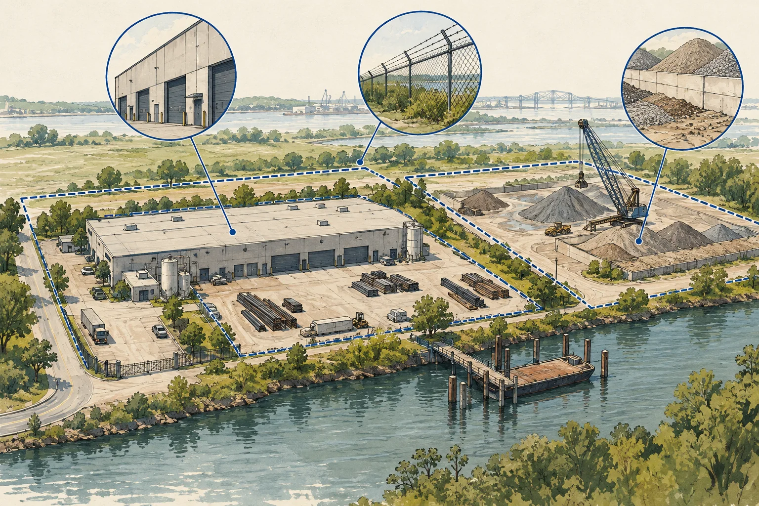
Conceptual editorial illustration of define the industrial operation before counting it.

The useful distinctions

Make the review specific.

01

Separate parcel and operation

A local parcel record is a useful identifier, but the operating boundary must be established from additional evidence. The Loudoun schema keeps different acreage fields and plat references, reinforcing the need to preserve field meaning before combining values.

Source 1
02

Keep proximity as a candidate rule

The supplied IOS report uses a spatial clustering method. This can nominate relationships for review; it does not by itself establish a single acquisition object, access rights or common control. This guide uses that limited methodological lesson.

Source 1
03

Account for the spaces between buildings

Yards, loading areas and shared circulation can be material to an industrial operation. Record the space, the interest offered and the source supporting control. Physical adjacency should not silently fill a missing rights document.

From the supplied IOS study

A candidate grouping still needs a control review.

Use the report’s clustering method to nominate a relationship for investigation. The fictional footprint exercise below does not reproduce or validate the underlying candidates.

A useful clustering method, with a bounded conclusion

The five cluster-size buckets sum to 2,010 candidates. Of those, 1,848 are in multi-parcel clusters: 91.94%, rounding to the reported 92%. The method chains candidates within a quarter mile. That proximity does not establish shared access, common control, usable yard or an achievable assemblage.

Northern Virginia IOS report · August 2026; sample revised September 11 · PDF pages 5. We checked this arithmetic, not the underlying records.

Observation to next action

What the evidence supports, and what to ask next.

Evidence in the fileWhat it describesNext review
Two adjoining parcelsA possible groupingCheck what interests are offered and how the operation uses both.
One owner labelA recorded relationship to examineReview current ownership and the exact parcels or interests covered.
Shared driveway on a planA physical access arrangementRequest the relevant rights and operating constraints for the proposed use.
Conceptual editorial illustration of define the industrial operation before counting it.

Work through the file

Industrial footprint worksheet

Use this sequence with the documents available for your file. Keep a reference with each observation and turn unresolved items into explicit requests.

  1. List the constituent records

    Keep parcel identifiers, building references and the broker’s offered footprint on separate rows before creating one asset ID. In the fictional exercise, marketing lists two parcels but the supplied lease names only one. Preserve both records and their dates. The discrepancy is a request for evidence about the offered interest, not a reason to discard the second parcel or assume it transfers with the first.

  2. Define the proposed grouping

    Explain which components form the candidate operation and why. Distinguish a contiguous site from nearby but separately controlled support space. Describe what the operator does in each building or yard and how it moves between them. Keep an illustrated shared drive as a physical observation until the access document is reviewed. A proposed grouping should retain the individual records so another analyst can challenge it.

  3. Test each relationship

    Request title, leases, plans and access documents relevant to the relationship being asserted. Ask counsel to identify the interests and benefited areas, and ask the civil reviewer to relate those documents to the physical route. Retain conflicting parcel references in the worksheet. An unmatched record stays unresolved rather than disappearing in de-duplication, and one verified relationship does not settle every other link in the operation.

  4. Accept a versioned footprint

    Record the reviewer, supporting documents and included interests for the accepted footprint, retaining excluded and unresolved components separately. In the fictional yard, drainage exclusions still need a measured basis and overlap review before an operating-area figure is used. Update the grouping when the offered property, source edition or intended activity changes. The worksheet preserves that decision trail but does not establish title or measured usable area.

Before using the output

Questions about this method.

What can AI check in an industrial grouping?

Ask AI to compare parcel schedules, lease exhibits and access-document references, flagging omitted IDs and conflicting area labels. Keep the proposed asset grouping separate from the source records. Title counsel should confirm interests and access rights, while a civil reviewer checks the physical footprint. AI cannot establish legal control from proximity or a common owner label.

Should we add parcel acreage together?

Preserve each original area field and its basis first. A sum of parcel areas does not establish usable operating area or resolve overlapping records.

Does the IOS study validate this fictional site?

No. The study informs the proximity-versus-control distinction. The worksheet example is invented and no underlying candidate rows are loaded.

From the page to your next task

Start with the useful output.

Parcel-to-operation grouping register

Build an editable parcel-to-operation grouping register, retain document references and open decisions, then export your team's working file.

Scope: One review file using the method in the accompanying guide. The example is fictional.

Bring
A name for the review file. Evidence status, observations and document references where available.
Leave with
Parcel-to-operation grouping register with editable, expandable records and document locators Two fictional worked rows showing mismatches and decisions to review CSV and readable text exports with row provenance, method sources and edition A separate document-request companion with suggested reviewers

Edition 2026-09-30.1

Evidence and scope

Follow each claim to its source.

Loudoun parcel layer: field definitions

Loudoun County · Checked 2026-09-29

Observed schema lists GIS acreage, legal acreage, plat references and update fields.

  • Schema review only. No parcel query, acreage comparison or completeness audit was performed.
Open original source ↗
2026 Industrial Outdoor Storage: supplied report

NextAutomation; Caelon collaboration noted in report · Checked 2026-09-29

August 2026 regional candidate study; sample revised September 11. Page-cited methods and arithmetic reviewed September 29. Its regional label does not establish statewide coverage.

  • Report statements are attributed to the supplied edition. We checked selected arithmetic; underlying records were not reproduced.
  • Raw PDF and private identifiers are not redistributed here. Unresolved claims are omitted from page evidence.